
Submitted by John on Jul, 25
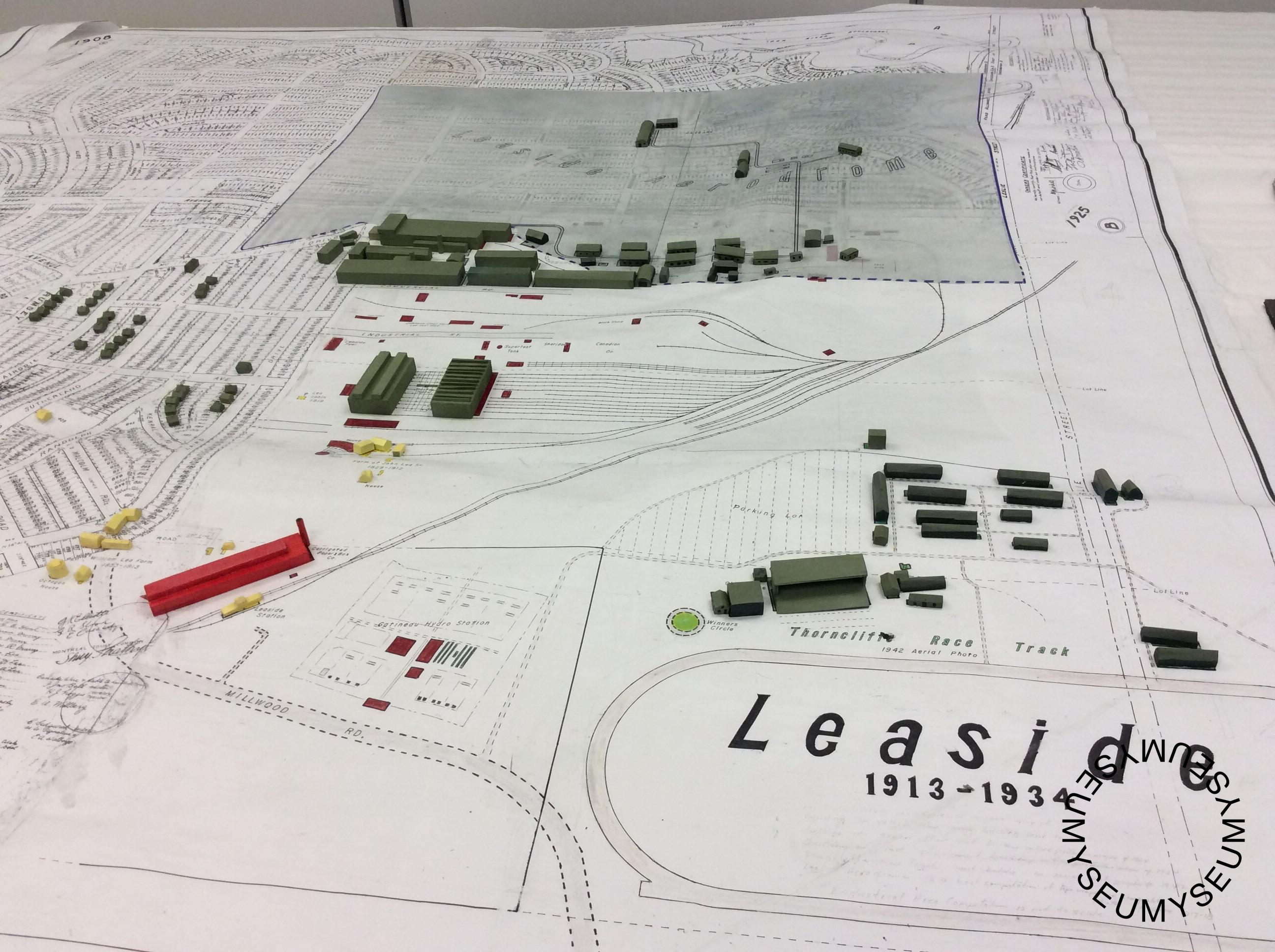
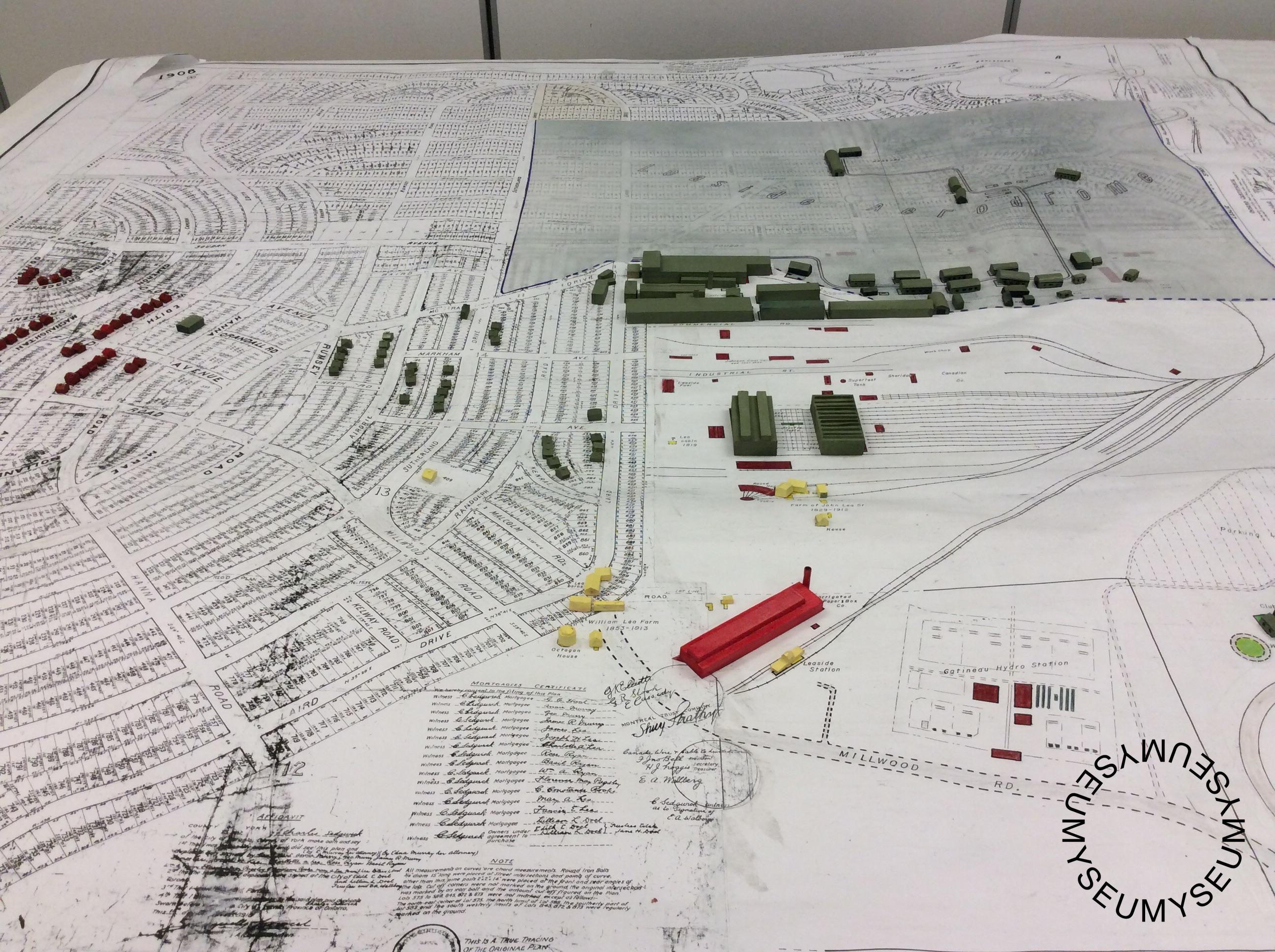
Leaside Map 1913-1934
Map of Leaside. The map shows 3/4 of residential area and 1/4 allocated for an industrial area with no defined roads or boundaries.
The map is based on two primary eras - Fire Prevention Data of 1924 and 1934. Captures the building data on the maps. The green buildings represent 1924. They consist of the Leaside aerodrome shown in green as hangars, Canada Wire and Cable (provided most of the wire and cable for Toronto), Canadian Northern repair facilities (located in the centre of the industrial area and the Thorncliffe Racetrack (1922-1952) which is on the outskirts of Leaside. The red buildings are the Bayview business section and an inventory of homes from that year. Lastly, the yellow buildings are the original farm buildings of the Leaside farming community.
What does it add to the story of Toronto?
These maps are the original survey maps of Leaside from 1913 showing the boundaries, lot numbers and dimensions with all of the street names. It directly relates to the beginnings of a new age in Toronto and is home to a lot of the pillars of Toronto history.
How did you acquire it?
This map is from the Toronto Archives, a copy was taken and there are rumours that the Archives couldn't find the original either. This is a copy.
How old do you think it is?
The map is from 1913.